Ohio weather monitoring lags behind. A new network could mean better forecasts
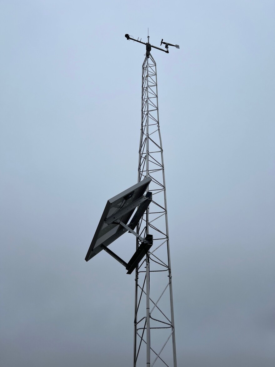
On a farm in rural Clark County in southwest Ohio, fallow fields stretch as far as the eye can see. In the middle of them, there’s a 35-foot tower.
“You're looking at one of [Ohio’s] first mesonet stations,” said Aaron Wilson, the state climatologist of Ohio and an ag weather and climate field specialist with Ohio State University Extension.
He and mesonet manager Jim DeGrand explained how the high-tech device captures detailed local weather conditions.
“So way up there at the top is our top measurement level at 10 meters,” DeGrand said. “We're measuring wind speed and direction. We're measuring solar radiation. We're measuring temperature and humidity up there.”
They’re taking those same measurements, plus some, closer to the ground too.
Ohio has nine mesonet stations like this one collecting detailed information on local environmental conditions.
“This one, right here, that's measuring leaf wetness,” DeGrand said.
Nearby, there’s a giant precipitation gauge and underground, sensors monitor soil temperature and water content.
All of this information is really helpful to people like farmers and atmospheric scientists. But in Ohio, it’s currently not being monitored very consistently, which means less accurate information both for the state’s biggest industry – agriculture – and for all of Ohio during severe weather.
Wilson and DeGrand hope a network of new mesonet stations will change that.